- China is one of the countries with the most geological heritage sites in the selection
- The first group of seven geological heritage sites selected by China covers scientific fields such as petrology and geographical lakes
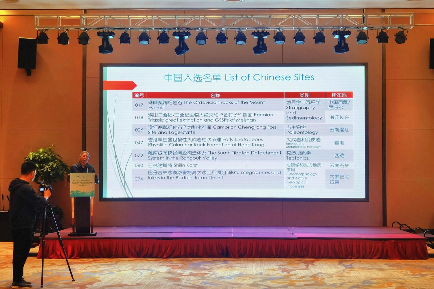
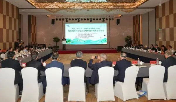
On October 26, 2022, the International Union of Geological Sciences (IUGS) announced the first batch of global geological heritage sites in Spain. Seven Chinese geological sites, including the "Golden Nails" geological section in Changxing, Zhejiang province, were selected.
The first batch of seven Chinese geological heritage sites are: Everest, zhejiang changxing ordovician rock mountain and the Permian/Triassic mass extinctions "golden spike", yunnan chengjiang fossils of the Cambrian fossils and library, Hong Kong early cretaceous acidic igneous rocks columnar joints, the south Tibetan flannelette canyon decollement system, yunnan stone forest karst, the badain jaran desert in Inner Mongolia will root tall sand hills and lakes.
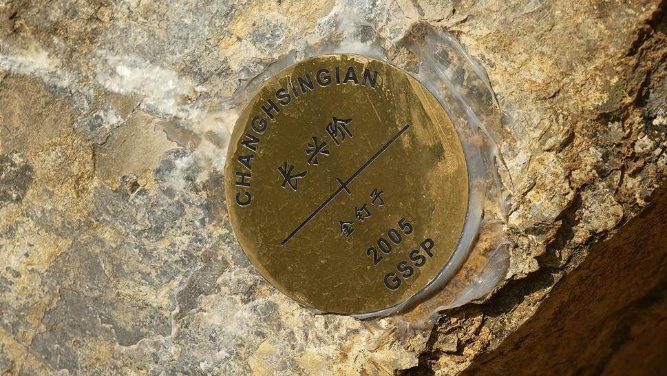
Permian/Triassic mass extinction and Golden Nails Section: The Golden Nails section of Coal Mountain in Changxing County, Zhejiang Province, contains two "golden nails" officially confirmed by the International Commission on Stratigraphy of the International Union of Geological Sciences -- the Permian-Triassic boundary and the bottom boundary of Changxing.
This section completely records the largest extinction event in the geological history 252 million years ago, which resulted in the extinction of more than 80% of the living species in the sea and land in a short period of time. It provides an extremely important historical reference for understanding and protecting the living and environment of the Earth today.
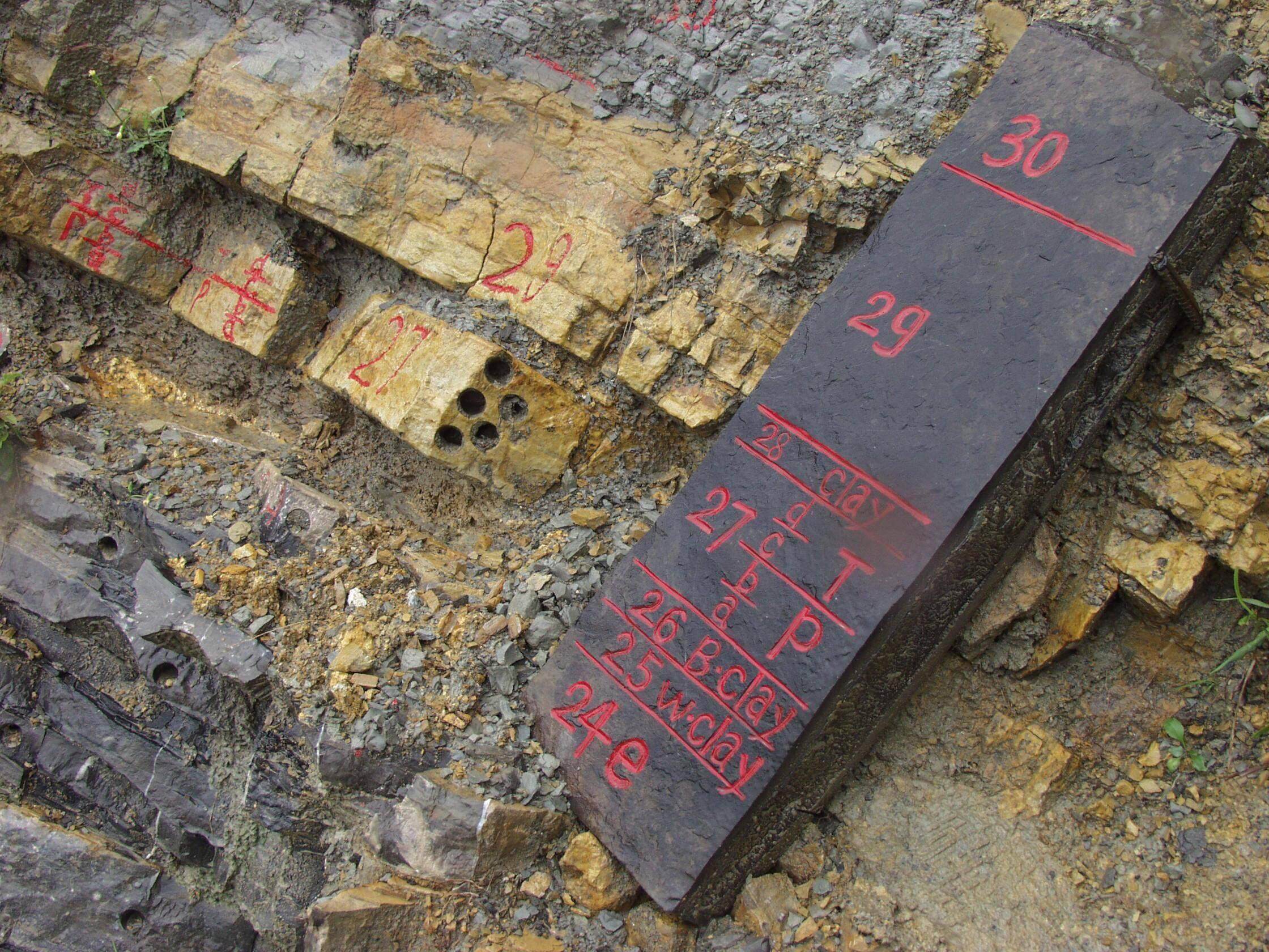
The strata of the coal mountain section continuously span the Palaeo-Mesozoic boundary and contain more than 300 species of conodonts, ammonites, brachiopods and fishes. In addition to fossil studies, the mass extinction of organisms, the "golden nail" time scale and environmental change processes in this stratum have attracted worldwide attention, and it is one of the most highly studied stratigraphic sections in the world.
Bilut High Sand Mountain and Lake in Badain Jaran Desert: Bilut High sand Mountain and Lake in Badain Jaran Desert are located in Alashan Desert World Geopark in Inner Mongolia.
The Badain Jaran Desert, located at the northeastern edge of the Qinghai-Tibet Plateau in the transitional zone of westerly monsoon winds, covers an area of about 49,200 square kilometers. It is the fourth largest desert in the world and the second largest mobile desert in the interior of Asia. In addition to the high sand mountains, there are more than 140 lakes scattered throughout the desert.
The Badain Jaran Desert is an ideal area for studying the climate change at the end of Quaternary, wind geomorphology and water resources in arid areas during the uplift of the Qinghai-Tibet Plateau. The highest peak in the desert is about 1,611 meters above sea level, with a relative height difference of nearly 500 meters. It is the highest sand mountain in the world, and is known as the "Mount Everest in the desert".
Early Cretaceous acidic igneous columnar joints in Hong Kong: A cluster of Early Cretaceous rhyolite volcanic rocks in the Saigon Volcanic Park, UNESCO World Geoparks, Hong Kong, derived from volcanic activity in the area about 140 million years ago.
At the time, there was a supervolcano southeast of Hong Kong that eventually formed millions of rock columns after three million years of violent eruptions. Unlike hexagonal volcanic columns around the world, the Hong Kong Geopark columns are rarely formed from acid rhyolic volcanic rocks rich in silica.
With an average diameter of 1.2 m and a maximum thickness of 3 m, the total extant thickness of the pillars is estimated to be 400 m, with a height of 100 m above the surface. Long-term coastal erosion has left these rock pillars exposed. Combined with the rich Marine erosion landscape, these rock pillars are a rare geological wonder in the world and one of the most representative geological sites in Hong Kong.
Shilin Karst, Yunnan: Located in Shilin Yi Autonomous County, Kunming City, Shilin Karst is a typical plateau karst with an altitude of about 1600 meters to 2200 meters and an area of 350 square kilometers. It preserves and exhibits some of the best sword-shaped karst (stone forest) landforms in the world, and is where the term "stone forest" originated.
The formation of stone forest karst has experienced a complex geological evolution process spanning 250 million years. Different stages of stone forest constitute a unique "generation" history, which is rare to show the evolution process of the earth in a special area. Almost all similar stone forest landforms in the world are gathered here, so it is known as the "Stone Forest Karst Museum". In addition, there are funnels, stone buds, dark rivers, lakes, karst caves, natural Bridges, waterfalls and other karst landforms in the geological heritage site, which constitute a karst panorama from the ground to the underground.
Chengjiang Cambrian FOSSIL AREA AND FOSSIL REPOSITORY: ABOUT 520 million years ago, THE Cambrian CHENGJIANG fossil Group is a rare fossil treasure house, rich in fossils and exquISitely preserved, vividly reproduce the real face of the Marine life world at that time, fully showing the early Cambrian biodiversity.
The fossil represents the starting point of modern biological diversity, to the vast majority of the evolution of the modern animal category history dating back to the early Cambrian, to reveal the mystery of the "Cambrian explosion" life provided extremely valuable evidence, has been hailed as "one of the most amazing scientific discoveries of the twentieth century", an early life science research has opened up a important innovative research field.
Rongbu Gorge detachment tectonic system in Southern Tibet: Rongbu Gorge is located on the north slope of Mount Qomolangma in the southern part of the Qinghai-Tibet Plateau, which is a typical area for the development of the detachment tectonic system in southern Tibet. The detachment tectonic structure of the detachment tectonic system in southern Tibet has been described and studied in detail here, which has important scientific value.
Rongbu-gorge detachment system in southern Tibet is a group of low Angle normal fault ductile shear zones in parallel orogenic belts, and its structure protruding from the summit of Mount Qomolangma is the highest fault on earth. The results show that the ductile shear detachment tectonic system of Rongbu-Gorge in southern Tibet is mainly of extensional character, and the limestone on the top of Qomolangma slides northward along the fault.
Ordovician Rocks of Mount Qomolangma: The summit of Mount Qomolangma is made of limestone that was formed about 460 million years ago (Ordovician Period) in a warm, shallow ocean. The rocks, which contain fossils of Marine animals, represent tropical Marine life from one of the most important periods in Earth's history, the Ordovician Great Radiation Period, which is now mostly extinct. These rocks, formed in the ancient Tethys Ocean, were pushed and lifted to their current position when the Indian plate collided with the Asian continent.
The Ordovician rocks here were identified in the 1970s by a team led by the Chinese Academy of Sciences after detailed mapping and sampling of the area, which is still being studied.
According to Shen Shuzhong, an academician of the Chinese Academy of Sciences and professor of Nanjing University, the publication of the world's first list of geological heritage sites highlights the unique value and significance of geological heritage in studying the long process of earth evolution and promoting natural ecological environment protection. "The seven projects selected by China are of great significance to the study of geological evolution in Asia, the popularization of geological knowledge among the public, the enhancement of the international influence of China's geological heritage, the promotion of international geological research cooperation, exchanges and mutual learning, and the building of a community with a shared future for mankind."
It is understood that the selection is held to celebrate the 60th anniversary of the International Union of Geological Sciences, the 100 selected geological heritage sites by 36 election committee members from around the world to 56 countries applied for 181 candidate geological heritage sites selected by comprehensive assessment, China selected the first 7 geological heritage sites, It covers the scientific fields of petrology, structural geology, stratigraphic paleontology, geographic lakes, geomorphology and so on, and plays an important role in the study of the formation of mineral resources, the evolution of life, the origin of human beings and other scientific fields. Editor/He Yuting
Comment
 Praise
 Collect
 Comment
 Search





Write something~